
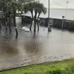
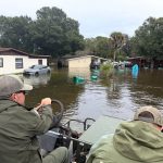
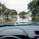
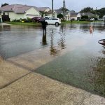
BREVARD COUNTY, Fla. Major flooding continued along the St. Johns River west of Cocoa on Friday morning as the National Weather Service issued new flood warnings for northern Brevard. Rising river water closed State Road 46 in both directions between Mims and Sanford. In Palm Bay, emergency crews used boats Thursday to help evacuate residents from part of Palm Bay Estates. marine.weather.gov
North Brevard, Merritt Island and the beaches
The National Weather Service issued a flood warning through 1:30 p.m. Friday after radar indicated that 3 to 4 inches of rain had fallen in the warned area. Forecasters named Titusville, Mims, Scottsmoor, Port St. John, Sharpes, Canaveral Groves, Cocoa and Rockledge, along with Merritt Island, Cape Canaveral, Port Canaveral, Cocoa Beach and Satellite Beach. The bulletin also named Playalinda Beach, Haulover Canal, Merritt Island National Wildlife Refuge, Titusville Airport, Patrick Space Force Base and Lone Cabbage Fish Camp. A separate flash flood warning for part of far northern Brevard was issued through 12:30 p.m. forecast.weather.gov
An earlier warning that ran through 8:30 a.m. also flagged Viera, Palm Shores, South Patrick Shores, Bellwood, Canaveral Acres and Jetty Park. The warnings describe areas where flooding was occurring or expected. Friday morning reports did not establish street-by-street conditions across those communities. forecast.weather.gov
St. Johns River flooding west of Cocoa and near Rockledge
The St. Johns River gauge west of Cocoa reached 18.6 feet at 2:15 a.m. Friday, more than two and a half feet above flood stage. The weather service forecast a crest of 18.7 feet and kept a river flood warning in effect until further notice. marine.weather.gov
The river bulletin identifies Lake Poinsett west of Cocoa, Shakespeare Park in Cocoa and the Silver Pines subdivision in Rockledge as areas where water can enter low-lying homes at levels below Friday’s reading. It also identifies Providence Road as an access problem for homes near Mullet Lane and Bass Road, and the docks and parking lot at Lone Cabbage Fish Camp as vulnerable to flooding. marine.weather.gov
Palm Bay, Melbourne and West Melbourne
In Palm Bay Estates, the city ordered mandatory evacuations Thursday for residents west of the canal and east of the railroad tracks. The evacuation was voluntary for the rest of the community. Thursday’s city closure list included Indian River Drive at Palm Bay Estates, Port Malabar Boulevard at U.S. 1, and Port Malabar Road at Daytona Drive. The Friday morning sources reviewed did not establish which of those streets had reopened or whether the evacuation order had changed. palmbayer.com
In Melbourne, flooding was reported on Sarno Road Thursday. In neighboring West Melbourne, the city reported at 8:30 a.m. Friday that all major roads were open and advised drivers to continue using caution. A broader flood watch for Brevard was scheduled to run through 7 p.m. Friday. palmbayer.com
Road closures, schools and shelter
Brevard County reported at 6:20 a.m. Friday that SR 46 was closed in both directions between Mims and Sanford because of the rising St. Johns River. Other roads reported closed Thursday included stretches of U.S. 1 near Carter Road, SR 405 and Coquina Avenue, as well as County Road 402 near Playalinda Beach Road and SR 401 near Charles M. Rowland Drive. Check Florida 511 for current conditions before leaving. County emergency management urged residents to stay off the roads if possible and to turn around when they encounter standing water. brevardfl.gov
Brevard Public Schools and county government offices were closed Friday. The county opened a shelter Thursday at the Walter Butler Community Center, 4201 N. Cocoa Blvd. in Cocoa, for residents displaced by flooding, including people with special medical needs and households with pets. Call 211 for current shelter information and assistance. County updates are posted on the Brevard County Storm Center.